Khartoum Case Study

Using GeoidApp to evaluate recent GOCE/GRACE models on Khartoum

Sudan, like other developing countries lack a unified datum. We have had a datum, but it's too outdated, and can't be used a reliable reference. In 2008 Ahmed Abdalla proposed a new datum for Sudan, which is by far more accurate than any previous attempts. Our research is not by any mean interested in establishing a new datum for Sudan.
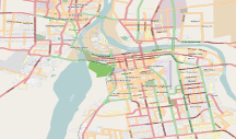
khartoum

“This is far from being trivial: we now have a method to replace leveling, a tedious and time-consuming old fashioned method with GPS leveling, a fast and modern technique.”

— Moritz et al, Physical Geodesy 2

Challenges:

  • We have a few terrestrial data to evaluate ICGEM models on
  • Obtaining such a data is not even an easy task.

Why GeoidApp:

  • GeoidApp relies on Molodnskey of using the quasi-geoid instead of geoid.
  • We can use parameters from satellite to solve for various degree and order for spherical harmonics.

Approach:

  • Use the new method of modeling the earth instead of the old-expensive method
  • Try different models, with different degrees and evaluate each with respect to our terrestrial data.
  • Choose the model and degree that result in the smallest standard deviation

Results:

We found very interesting results. One thing we found is that the standard deviation largerly changed from the old astrogeodetic data, compared to recent GPS/leveling data. Which suggests that the previous data can no longer be used.

  • We need more GPS/leveling data to evaluate ICGEM models.

About the theory

Maybe I'll get to write it later. It will be about using spherical harmonics for modeling the earth.